


Highway 89 wound up 15 miles from the Houserock Valley to Jacobs Lake climbing most of the way through small canyons and ridges. From Jacobs Lake it was pretty level for about 10 miles in a northwesterly direction then it dropped rapidly down for 5 miles to a sage brush flat 15 miles from Fredonia.
Highway 67 went south from Jacob Lake through a heavy forest of Ponderosa Pines most of the way. The last 15 miles before entering the North Rim of the Grand Canyon National Park was big open meadows called VT park.
One of the rare sights to see in the Kaibab forest was a Kaibab White Tailed Squirrel. I would see them often except in winter.
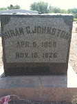
After I was in the area a short time my Sargent brought me a bunch of wooden crosses. I was instructed to place a cross on the highway shoulder where a highway death had occurred.
I asked the the Highway maintenance crew where death had occurred prior to that time. They told me about “Death Curve” where I was to put up 7 crosses. This was a curve near the bottom of the road going down toward Houserock Valley. The road made an almost 90 degree turn where the canyon turned sharply. If you didn't slow down and negotiate the curve you would run into a solid cliff. The road was pretty straight approaching the curve so many accidents had happened there.
The 7 crosses were for a wreck where 5 members of one family had died. There had been two other accidents where a single person had been killed.
The maintenance crew told me of the names of other curves on the road all going Southwest on Highway 89.
About five miles from Jacobs Lake was a curve they called “chicken curve.” Several years earlier a semi truck loaded with live chickens in cages had wrecked going too fast and had scattered chickens everywhere. The people from Kanab, Utah and Fredonia had rushed up to the wreck and salvaged a lot of chickens.
The insurance covered the lost chickens so the local people had a lot of chickens.
Truckers seemed to pick up too much speed going southeast from Jacobs Lake. The curve after the “chicken curve” going southeast was called “potato curve.” A potato farmer up in Idaho had a bobtailed truck so he would haul potatoes South into Arizona on his own and sell them. In the fall of 1953 he had a wreck on “potato curve” and scattered potatoes all over the area. The Kanab and Fredonia people salvaged the potatoes and had a lot of potatoes to eat that winter. The insurance company took care of the farmer. He got a new truck and I got acquainted with him at the checking station as he came through with his potatoes several times each fall. I reminded him to slow down on “potato curve.”
In the fall of 1954 a big semi truck wrecked on the first curve southwest of Jacob's Lake about 2 miles. He was loaded with boxes of prunes from California.
I had always thought prunes were just dried plums but these were real prunes picked by “California prune pickers.” They were big juicy prunes.
When word got out a lot of people came from Kanab and Fredonia and salvaged boxes of prunes. We got a few boxes and Wanda and I put them up in jars. We are prunes for several year from that wreck. They were delicious.
I was able to name that curve “Prune curve.” None of the prune salvagers suffered from constipation.
None of the truck drivers ever got injured in these wrecks.
On the way to the North Rim on Highway 67, the first 20 miles or so is pretty straight but just before you entered VT part, where all of the large meadows are, the road winds around some. One Saturday afternoon on one of the curves a young couple in a convertible with the top down wrecked going real fast.
The couple were from California an a weekend visit to the Grand Canyon. They were both killed when the car flipped over onto it's top and went scooting off into a small meadow on it's top.
I found a ticket in the glove compartment written hours before on old 66 highway near Seligman by Chick Harddup, a highway patrolman.
I named this curve “convertible curve” and put two white crosses on it.
In the fall of 1956 the Mackelprangs were moving their cows from their ranch adjacent to the Buffalo ranch in the Houserock Valley back to their home place in the Kanab area in Utah. They had hauled their horses from Kanab in a bobtailed truck and sorted the cows and calves. They had loaded the cows only in a big semi cattle trucks and headed for Kanab toward evening.
Northwest of Jacob's Lake about 10 miles is a rest stop and view point where you can overlook Fredonia and Kanab in the distance. A couple of hundred yeard past this view point the road starts winding down a canyon. The cattle truck was going too fast as he went into the first curve so he flipped to his left side and went plowing through the pinon pine and juniper trees on the left side for quite a distance down a ridge.
I came upon the accident shortly after it happened. The small truck carrying the Mackelprangs and their horses was right behind the cattle truck. They found that 6 cows were killed. They unloaded their horses and were able to herd the remaining twenty or so cows down the road to a corral at the bottom of the mountain. I had the inspection station operator warn each South bound car about cattle in the road so no one ran into the cattle. It was getting dark by then.
The truck driver wasn't hurt. I got the necessary information for my reports and then I wondered; what to do with the six cows. The driver said “Don't worry about them. The Navajos will take care of them.”
Earlier in my tour of duty there I had learned that if a Navajo Indian finds a dead animal, they take everything but the feet and a pile of the stuff they squeeze out of the guts. From time to time I had found 4 cows feet and an ant hill like pile of what was in the guts. I also found deer and sheep remains.
A big wrecker had to come from Cedar City, Utah to set cattle trucks on its wheels. I drove on home and had supper and when I came back to assist the wrecker I found 6 sets of four feet and 6 piles of green stuff from the guts where the six cows had been laying. The Navajos that worked at the saw mill in Fredonia had been on their way home to spend Sunday at their homes on the reservation, saw the dead cows and helped themselves.
The people of Kanab and Fredonia didn't get to salvage any beef but the Navajo people sure did well. That curve is now “Cow curve.”
No comments:
Post a Comment